Optical based Flood processing chain
Service using Sentinel-2 and Landsat-8 data and an automated Water Extraction tool developed and integrated in GEP by eGEOS to extract water bodies to support flood mapping.
EO sources supported:
- Sentinel-2
- Landsat-8
Output specifications
- water mask GeoTiff file)
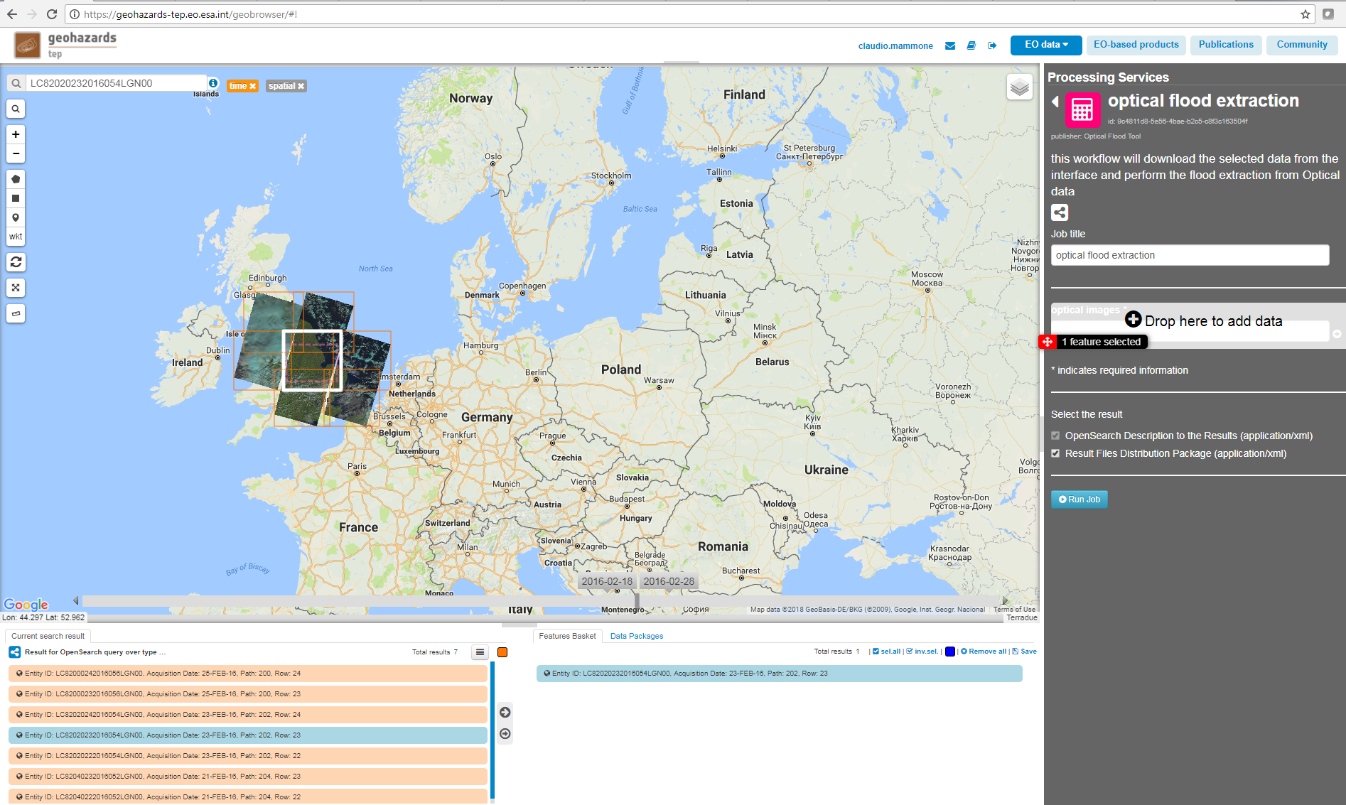
Then select from the list the “Optical-flood-trial-case” data package and click on load. The service works with Landsat-8 images and with tiled Sentinel-2 data (e.g. the filename starts with “S2A_MSIL1C_”). The selected data package contains the reference to the following input file:
LC82020232016054LGN00

Define values for the “Job title” and the “Optical images” fields.
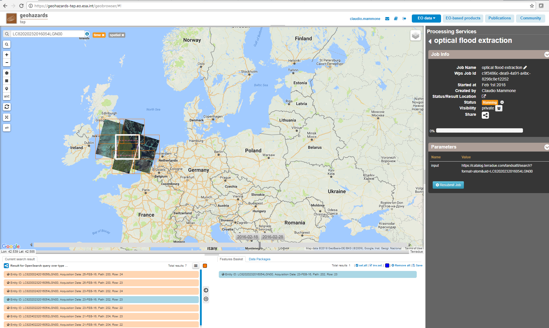
Optical flood extraction
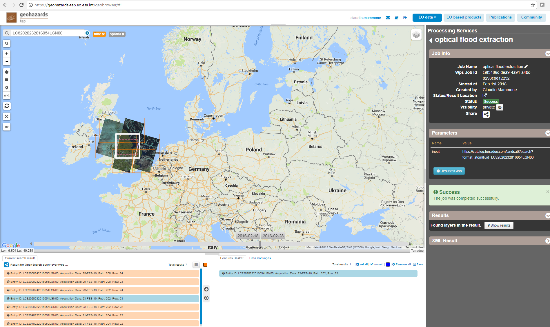
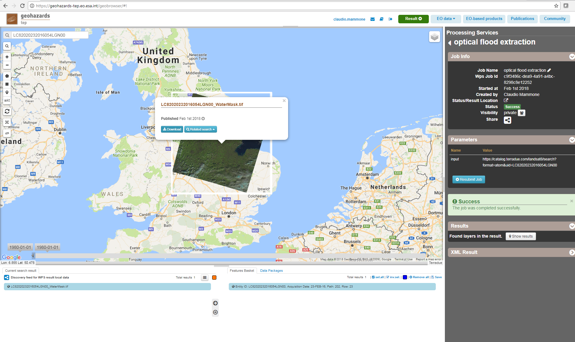
The output of the service (water mask) is a GeoTiff file, represented in int format, with “100” value where the water is present, “0” otherwise.